
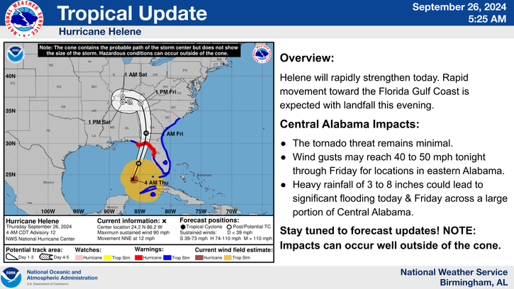


Hurricane Helene is expected to hit land late Thursday and cause severe weather in Central Alabama beginning Thursday evening into Friday.
The storm is headed to the north Gulf Coast along the Florida panhandle. As of Wednesday morning, Helene’s path has shifted further westward with it affecting both Georgia and Alabama.
Elmore, Tallapoosa and Coosa counties have been issued a wind advisory through midday Friday. The area could see 10-25 mph winds with up to 35 mph wind gusts.
Elmore, Tallapoosa and Coosa counties have also been issued a flood watch until 7 a.m. Friday. With excess runoff affecting streams, rivers and other bodies of water, remember “turn around, don’t drown” and do not drive around barricades.
A tornado threat remains minimal for much of Central Alabama. The area is expected to see heavy rainfall, 3 to 8 inches, Thursday and Friday, which could lead to significant flooding. There is also a chance of 40-50 mph wind gusts in east-central Alabama through Friday.
“Please prepare now by having multiple reliable ways to receive your weather information,” Tallapoosa County EMA director Jason Moran said in an email. “NOAA weather radios are one of the most reliable ways of getting information."
