


As Hurricane Francine hits landfall, becoming a tropical depression, the bands of the storm still pose a threat for Central Alabama.
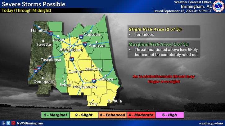
From now until midnight, Elmore County and Coosa County remain at a slight risk, level two out of five, with possible tornadoes. Meanwhile the northeast portion of Tallapoosa County is at a marginal risk, level one of five. The rest remains in a slight risk.
Regardless, an isolated tornado threat lingers overnight across Central Alabama.
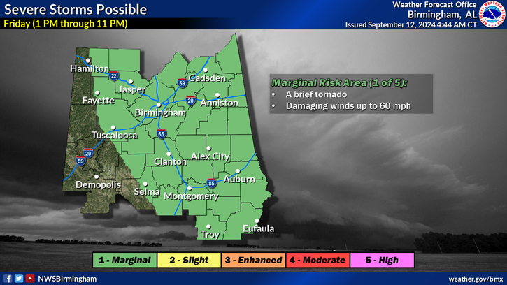
Looking into Friday, Central Alabama moves into a marginal risk with possible damaging winds up to 60 mph and possible brief tornadoes until 11 p.m.
Heavy rainfall continues with a potential 4 to 6 inches of rain for surrounding areas through Sunday. As such, a flood watch continues for Central Alabama through Friday as well as a wind advisory with gusts up to 45 mph.
Wednesday, Hurricane Francine approached the Louisiana coastline and hit landfall that evening.
