

Elmore County has a recent history with tornadoes — 2011 and 2019.
Thanks to Tuesday's strong storms, now the county can mark April 4, 2022 in the books as well.
Lacey Funderburk has been a part of two stormy days. Her home on Neman Road in Claud was damaged Tuesday.
“I saw it coming [Tuesday] morning and knew we didn't have time to go nowhere,” Funderburk said. “We were wanting to get out. I went through 2011, just not this close.”
Trees were laid down in Funderburk’s yard, her new porch was gone too, both front and back.
“It got all of it,” Funderburk said.
The storm peeled back parts of the roof and flipped a shed. Funderburk said it was a different experience than more than a decade ago.
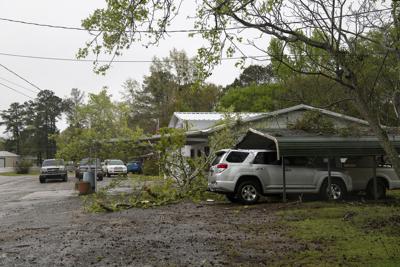
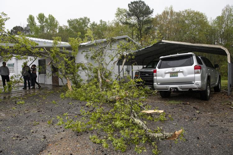
PHOTOS: Storm Damage in Elmore County


“The only thing it did in 2011 was take off a few shingles,” she said.
Funderburk saw what she believes to be a tornado coming straight at her home and tried to get to a closet with an elderly relative.
“I told her we got to go,” Funderburk said. “We got to the hall she went down and I went down on top of her.”
Funderburk was lucky, as was everyone else in Elmore County, as the storms passed through.
Sign up for Tribune Newsletters
Success! An email has been sent to with a link to confirm list signup.
Error! There was an error processing your request.
Elmore County’s Emergency Management Agency Director Keith Barnett said there were no injuries reported in the 11 miles of damage across the county. Barnett said the first four mile track starts in Wetumpka near Harrogate Springs Road and Jasmine Hill Road.
Barnett said crews were still working to clear the road of trees and powerlines and roads are closed in areas. First responders are trying to let homeowners through around heavy equipment as they can.
The second track starts in the Claud community and runs seven miles through Kent. Barnett said all had multiple reports of trees down, some five to 15 homes with trees on them and utility lines down.
“Some are duplicate reports,” Barnett said. “They will be cleared as damage assessments are done.”
Those assessments will occur over the next few days but not during storms Wednesday’s predicted storms.
“We will not be out doing damage assessments as weather is coming in,” Barnett said. “We will get out there and do them.”
Barnett said assessments will be done by the end of the week and it will be up to the National Weather Service to determine if the damage was done by one tornado or more. Barnett and the National Weather Service will also be working together to figure out how to get more time for warnings of severe weather.
“We would always like to have more notification of a potential tornado touchdown,” Barnett said. “As soon as they saw something it was communicated that we were put under a tornado warning. We will be working to see what type of timeframe we had between when they saw rotation and when we had reports of damage to see where we can improve.”
Barnett said 15 safer places to shelter opened Tuesday and shelters for Wednesday will be posted as needed.
Barnett was pleased with all the first responders who worked Tuesday’s storms starting with the three 911 dispatch centers in Elmore County in Millbrook, Wetumpka and Tallassee. They took hundreds of calls as the storm moved across the county.
“What an amazing job by all the first responders in this incident,” Barnett said. “That includes dispatchers, fire departments, police departments, sheriff's office, [Alabama Law Enforcement Agency], city and county public works, [Alabama Department of Transportation], Alabama Power Company, Central Alabama Electric Cooperative, Haynes Ambulance and many others.”